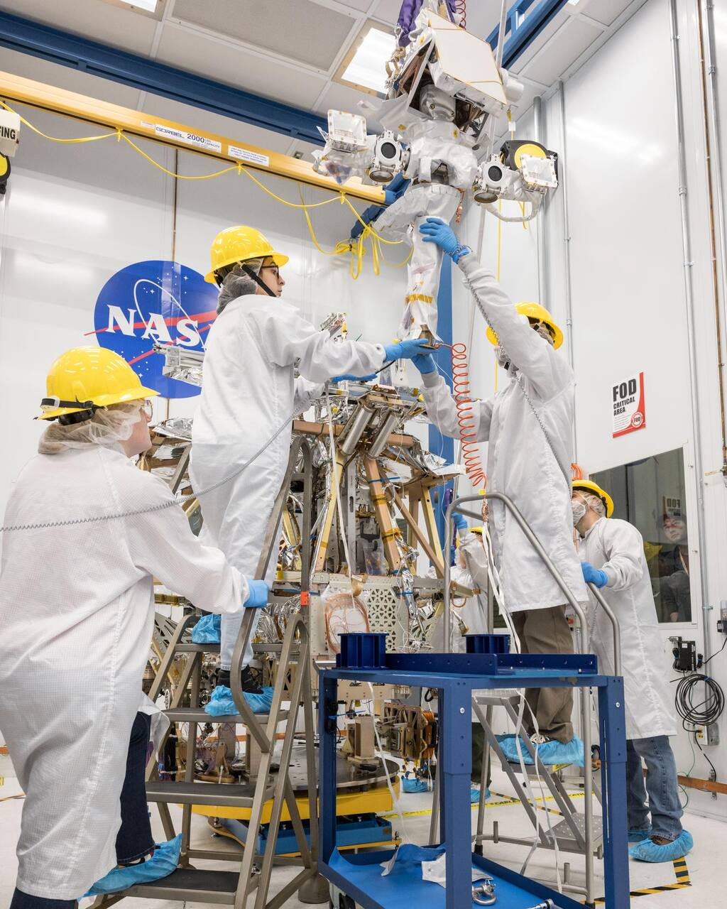
 NASA/Helen Arase Vargas. Public domain (NASA / US government work).
The problem
Section titled “The problem”VIPER was designed to prospect for water ice at the lunar south pole with a solar-powered rover: to characterize the distribution and physical state of polar volatiles in cold traps and regolith, and to supply the data needed to judge in-situ resource utilization [10], [14]. Orbital sensing constrains where hydrogen is, not its form or its subsurface distribution at rover scale [14].
The environment sets four requirements. Permanently shadowed regions receive no direct sunlight, so the rover must work in terrain colder than any prior planetary rover has seen, and the design environment is 30 to 300 K, an expectation rather than a demonstrated range [3]. Sunlit terrain has a grazing Sun, so power depends on arrays pointed at the horizon [3]. The regolith has never been sampled at the pole, and the strength used to size wheels and drills is inferred from Apollo-era data and simulants [5], [4], [19]. The round trip to Earth is 6 to 10 seconds end to end, which forces teleoperated driving with a large ground team [2].
What has flown
Section titled “What has flown”No VIPER hardware has operated on the Moon. NASA removed the rover from Astrobotic’s Griffin Mission One in January 2024 and announced the project’s end in July 2024 [3]. In September 2025 NASA awarded Blue Origin a CLPS task order to deliver it on the second Blue Moon MK1 lander, targeted for late 2027 [17].
The only flown VIPER hardware is the TRIDENT drill twin on PRIME-1. The lander came to rest on its side and the drill completed a 20 minute functional checkout, so no lunar hole has been drilled [15]. The ancestor, Resource Prospector, was canceled in 2018 and never flew, and the held briefing records only an engineering test unit rover and a notional 2 km traverse [12]. It fixed the operating concept VIPER inherited: a neutron spectrometer to find hydrogen, a near-infrared spectrometer to read the surface at the drill site, and an auger to 1 m. Its one relevant-environment test was a Canadian auger drill run in a thermal vacuum chamber in simulant with 1 percent water at -80 C, with NIRVSS watching the borehole, and the briefing gives no depth, rate or torque from it.
What did happen to the flight rover is ground qualification. The build completed on 4 June 2024; vibration testing finished on 5 July, acoustic testing at 138 dB on 23 July, and thermal vacuum testing, which reached 15 K with the mobility system, suspension, pan and tilt and lights actuated, on 16 September 2024 [3]. The rover entered storage in February 2025 [3]. Key rover deliverables ran 12 to 18 months late by 2023 [7].
What is being tried now
Section titled “What is being tried now”Each family below is labeled by how far it has been tested.
Rover as a geotechnical instrument (ground test, never flown). A torque transducer in each suspension joint gives wheel normal force, and a quadrature pattern on the inboard wheel rim lets the wheel-well hazard cameras read sinkage; the plan is to invert these through Bekker and bearing-capacity relations to cohesion, friction angle and bearing strength [1]. Software slip estimates agreed with motion-capture truth to 93 percent over 99 tests of 5 to 10 m on a surrogate in GRC-1 and Fillite simulants at 1 g [1]. Heldmann et al. add the IMU as a driving gravimeter and as a seismometer with the drill as source [14].
Predicting lunar mobility from 1 g tests (parabolic flight and simulation). Two parabolic campaigns showed that matching only wheel load overstates mobility: drawbar pull to weight fell 20 percent or more and sinkage rose up to 40 percent in lunar gravity at equal load; equal cone-index-gradient preparation, the assumption behind GRC-1, also overstates it, while granular scaling laws came within 8.5 percent on drawbar pull [20]. An extended scaling law for slopes has been verified for slip ratios of -0.2 to 0.9, but against discrete element simulation of one wheel in FJS-1 [34]. NASA’s best-practice report for the Lunar Terrain Vehicle records that no standard south polar simulant exists, so every simulant choice is an assumption [19]. Simulant property tests show that matching the lunar particle size distribution does not fix shear strength: one candidate highland simulant has cohesion about 355 percent above the lunar estimate [31].
Dust and wear protection (ground test). The mobility modules carry a 42-layer outer barrier with graded labyrinth, felt and spring-energized PTFE seals inside; a continuous dust-box run left no measurable simulant inside, and a 40 km equivalent wear run left the Kevlar intact [18].
Drilling and cuttings analysis (ground test, one flight checkout). The engineering unit drilled nearly 30 m over 337 bites in simulant and rock of 4 to 120 MPa strength [15]. Percussion is chosen because rotary drilling of ground ice took days per meter against under an hour for rotary-percussive [15]. Field campaigns in Bishop Tuff found the drill chokes in low-permeability welded tuff, exceeding torque limits and stalling at 48 cm in one hole [30]. Torque, weight on bit and penetration rate alone marked an ice-rock transition near 62 cm in Antarctica [9]. A load model for a lunar sampling auger found conveyance and extruding terms far smaller than the measured load in a dense simulant at ambient pressure [24]. Off-Earth drilling reviews list vacuum, thermal cycling, low weight on bit and dust in bearings as the main problems [22]. Mass spectrometry on the cuttings: with doped simulant at -178 C, the m/z 18 signal separated dry from 5 weight percent water bites, but signal fell as the pile grew [21].
Neutron and gamma sensing (design, ground calibration). VIPER’s NSS targets 0.5 weight percent water equivalent at 3 sigma while roving at 10 cm/s [10]. A miniaturized gamma-ray and neutron spectrometer derived from LunaH-Map has been proposed for the Endurance rover; this is a concept, not flown [23].
Thermal design and correlation (ground test). A VIPER loop heat pipe tilted to give a one-sixth g head showed conductance rising with load, 0.5 W/K at 40 W and 13.8 W/K at 200 W, with a thermal control valve holding the spreader at -22.2 C on 10.6 W [26]. Tilting reproduces the gravity vector only [25], [26]. The integrated thermal model was correlated by up to 14 analysts in 22 weeks to 7.4 C hot and 10 C cold RMS error [27]. Methods generalized for other polar vehicles note that local night at south pole safe havens can be as short as 50 h, commonly 85 to 150 h [28]. The system thermal vacuum test results had not been published in the held source [29].
Navigation in darkness (field and simulation, none flown). ShadowNav localizes against crater rims with a stereo camera and illuminator, reaching final position errors of 1.7 to 3.8 m in field trajectories [32]. A chance-constrained planner for solar-powered shadowed-region traverses is validated in simulation alone [33]. Mission-level Monte Carlo simulation of the Endurance concept gives 715.5 plus or minus 47.0 days [36]. The Canadian lunar rover lists shadowed-region endurance as a goal, not a demonstrated capability [35].
Site and ice modeling (orbital data and models). The Mons Mouton area has no boulders of 3 m or more in LROC at 0.9 m per pixel, and about 40 found in Chandrayaan-2 images have median height 14 cm, under the roughly 20 cm drive-over limit [8]. A fuzzy-logic prospectivity map uses expert-assigned weights not fit to measured ice [11].
The numbers
Section titled “The numbers”Specifications
Section titled “Specifications”| Parameter | Value | Source |
|---|---|---|
| Roving mass | 450 kg | [18] |
| Wheels | 4, independently driven and steered | [1] |
| Design thermal range | 30 to 300 K | [3] |
| Drill | 26.5 kg, 25.4 mm bit, 2 J per blow up to 972 per minute, 1 m depth in 10 cm bites | [15] |
| Science roving speed | up to 10 cm/s | [10] |
| Mobility actuators | TRL 7 at critical design review, TRL 8 in September 2024 | [13] |
| NSS sensitivity | 0.5 wt% water equivalent, 3 sigma, roving | [10] |
| MSolo | 4.8 kg, 30 W, mission scan range 0 to 70 m/z | [6] |
Mission profile
Section titled “Mission profile”| Parameter | Value | Source |
|---|---|---|
| Delivery | Blue Origin Blue Moon MK1, CLPS task order | [17] |
| Landing site | Mons Mouton, south pole | [8] |
| Duration | 100 Earth days (plan) | [7] |
| Primary mission area | about 5 by 4 km | [14] |
| Flight rover build complete | 4 June 2024 | [3] |
Reduced-gravity mobility methods
Section titled “Reduced-gravity mobility methods”| Method | Result against lunar-gravity data | Source |
|---|---|---|
| Equal wheel load | Drawbar pull to weight 20 percent or more lower, sinkage up to 40 percent higher in lunar gravity | [20] |
| Equal cone index gradient (GRC-1) | Overstates mobility, more than equal wheel load | [20] |
| Granular scaling laws | Within 8.5 percent on drawbar pull | [20] |
What is not established
Section titled “What is not established”All performance figures are design intent or ground test, so none are lunar surface results. Ground mobility tests run at 1 g or in short parabolas on simulants not matched to south polar regolith [19], [20]. Dust qualification lacked combined vacuum, thermal and dust testing, and the simulant was a mare material for a highlands site [18]. MSolo’s range is quoted as 0 to 70 m/z for the mission against 1 to 100 for the hardware, and all its limits of detection come from one laboratory campaign [6]. Drilling in icy regolith at polar temperatures rests on one cryogenic bin test and terrestrial field campaigns, and the flight checkout drilled no hole [21], [9], [15]. The gravity-head emulation of the heat pipe test reproduces one effect of one-sixth g [26]. Whether orbital cold-trap and stability-depth models match rover-scale ice is the measurement the mission was built to make [11].
References
- Rezich, E., Bickel, V. T., Francis, P. L., Rogg, A., Tardy, A., Creager, C., Oravec, H. A., Schepelmann, A., Ennico-Smith, K., Deutsch, A. and Hirabayashi, M. (2025). Investigating the Geotechnical Properties of the Lunar South Pole with NASA VIPER's Mobility System
. The Planetary Science Journal, 7. Source
BibTeX
@article{rezich2025investigating, title = {Investigating the Geotechnical Properties of the Lunar South Pole with NASA VIPER's Mobility System}, author = {Rezich, Erin and Bickel, Valentin T. and Francis, Parker L. and Rogg, Arno and Tardy, Antoine and Creager, Colin and Oravec, Heather A. and Schepelmann, Alexander and Ennico-Smith, Kimberly and Deutsch, Ariel and Hirabayashi, Masatoshi}, journal = {The Planetary Science Journal}, volume = {6}, number = {7}, pages = {169}, year = {2025}, doi = {10.3847/psj/add13f}, abstract = {Abstract The NASA Volatiles Investigating Polar Exploration Rover (VIPER) is capable of assessing the geotechnical properties of the lunar south pole’s terrain, specifically as they pertain to terramechanics or the wheel–terrain interaction, combining the rover’s mobility system and science payloads. This paper focuses on one key aspect of VIPER’s mission: the quantitative evaluation of geotechnical parameters via tractive performance by analyzing wheel and wheel–regolith interaction dynamics. As VIPER navigates the largely uncharted terrain of the Moon’s south pole, sophisticated onboard instrumentation will monitor and record detailed interactions between the rover’s wheels, chassis, and the lunar surface. These measurements will capture critical data such as wheel slip and sinkage, offering insights into the mechanical behavior of the soil under actual lunar conditions. The findings from VIPER are expected to provide a foundational understanding of the lunar south pole’s regolith mechanics, directly informing the design and navigation strategies of future lunar missions, including the deployment of more advanced rovers and crewed vehicles. By integrating lunar surface observations with the rover’s kinematic model and understood terrestrial mobility performance, the study aims to enhance predictive accuracy regarding rover tractive performance over sloped, level, and potentially volatile-rich terrain. Ground truth geotechnical assessments and proceeding mobility characterization work will serve as a cornerstone for verifying and improving both terrestrial test approaches and simulation models that underpin mission planning and risk management for subsequent explorations.} } - Mirmalek, Z., Lim, D. S., Colaprete, A. and Lees, D. (2025). Lunar science real-time operations and mission systems integration definitions and practices from NASA's VIPER mission
. International Conference on Space Operations, SpaceOps-2025, ID 294. Source
BibTeX
@inproceedings{mirmalek2025lunar, title = {Lunar science real-time operations and mission systems integration definitions and practices from NASA's VIPER mission}, author = {Mirmalek, Zara and Lim, Darlene S. and Colaprete, Anthony and Lees, David}, booktitle = {International Conference on Space Operations}, number = {SpaceOps-2025, ID 294}, institution = {NASA}, address = {Montreal, Canada}, year = {2025}, doi = {10.82217/spaceops2025_294}, abstract = {Mission system design for the National Aeronautics and Space Administration (NASA) Volatiles Investigating Polar Exploration Rover (VIPER) mission began with focusing on building key components including a solar-powered rover and the ground data system for operating it on the Moon for 100-Earth-days. The VIPER mission would be designed to support teams of people on Earth and a robot on the Moon carrying out a scientifically planned search for water ice, over a distance of 20 km. Initially, within the mission system design the involvement of VIPER’s science team (VST) was noted as “the science customer” - a designation and acknowledgement of a key workgroup in the mission. The VST’s work support needs, for a science work system, however, had not yet been defined by the VST in terms of systems and architecture. As the VST’s Science Operations team conducted research to develop a science operations system and architecture for VIPER’s science mission activities they found the science system needs for supporting real-time lunar science were greater than that which was designated in the mission system for the science customer. They decided to focus on developing the science operations system via ongoing integration rather than establishing a separate science component that later would be adjoined to the mission system. VIPER Science Operations enacted integration as an ongoing work practice; integration was a carried out as a regular activity that required schedule and agenda planning to be carried out on a daily and weekly basis, and adjustments in accordance with other workgroups’ activities. The work of integrating requires including and maintaining a greater number of considerations in the short-term work plan such as scheduling and product considerations (e.g., goals, interface features, networks, workspace build, mission simulations) and human relationships. In the long-term, ongoing integration approach can yield benefits that include fewer system conflicts, which can be avoided by learning of conflicts during development when they can be addressed. In addition to lunar science operations development and training with the VIPER Science team, integration included working with VIPER Mission system’s operating software workgroup, as well as the workgroups for rover drivers, planning and timelining, mission systems engineering, testing and training, and mission workspace preparation. This paper shows the work of integration as a process during the pre- surface operations development stage and highlights some examples of mission enhancing decisions that resulted from this integrated approach.} } - Andrews, D. (2024). VIPER Rover: Flight Build and Environmental Test Status
. International Astronautical Congress, 20240002248. Source
BibTeX
@inproceedings{andrews2024viper, title = {VIPER Rover: Flight Build and Environmental Test Status}, author = {Andrews, Daniel}, booktitle = {International Astronautical Congress}, number = {20240002248}, pages = {76-82}, institution = {NASA}, year = {2024}, doi = {10.52202/078357-0013}, abstract = {The NASA Artemis Program plans to return humans to the Moon to stay. Extended human stays on the Moon will require substantial resources to sustain human presence, requiring continuous supplies delivered from the Earth. However, if some of the resources were indigenously available, Earth logistical requirements could be substantially reduced by “living off the land” with in-situ lunar resources. Local volatiles could be processed into propellants and human life-supporting needs, reducing risk of maintaining a permanent human presence on the Moon. LCROSS, LRO and other missions have confirmed the presence of lunar volatiles resources in polar regions, so the next step is to understand the physical distribution of those resources, as well as the scientific basis for how water got there, and why it is still there. The Volatiles Investigating Polar Exploration Resource (VIPER) is a surface mobility scientific platform, designed to spend ~100 days mapping and surveying four different Ice Stability Regions to understand the scientific nature and distribution of water and other volatiles. VIPER will also provide scientific mineralogical context of the lunar regolith, such as the presence of silicon and light metals in lunar regolith, providing a composite picture of resource availability and sustainment. This paper will discuss VIPER’s completion of the flight rover build, as well as current progress in environmental testing, preparedness for mission operations, and overall readying for launch integration with our CLPS partner. VIPER is managed within NASA’s Science Mission Directorate (SMD), utilizing the Commercial Lunar Payload Services (CLPS) lunar delivery model} } - NASA. (2020). Cross-Program Design Specification for Natural Environments (DSNE), Revision G
. NASA Marshall Space Flight Center. Source
BibTeX
@techreport{nasa2020cross, title = {Cross-Program Design Specification for Natural Environments (DSNE), Revision G}, author = {{NASA}}, institution = {NASA Marshall Space Flight Center}, year = {2020}, url = {https://ntrs.nasa.gov/citations/20200000867}, abstract = {The DSNE completes environment-related specifications for architecture, system-level, and lower-tier documents by specifying the ranges of environmental conditions that must be accounted for by NASA ESD Programs. To assure clarity and consistency, and to prevent requirements documents from becoming cluttered with extensive amounts of technical material, natural environment specifications have been compiled into this document. The intent is to keep a unified specification for natural environments that each Program calls out for appropriate application.} } - Heiken, G. H., Vaniman, D. T. and French, B. M. (1991). Lunar Sourcebook: A User's Guide to the Moon
. Endeavour. Source
BibTeX
@book{heiken1991lunar, title = {Lunar Sourcebook: A User's Guide to the Moon}, author = {Heiken, Grant H. and Vaniman, David T. and French, Bevan M.}, journal = {Endeavour}, volume = {16}, pages = {96}, publisher = {Cambridge University Press}, year = {1991}, doi = {10.1016/0160-9327(92)90014-g} } - Aguilar Ayala, R., Captain, J. E., Smith, J. T., Hancock, M. L., Jarnot, A. W., Smith, K. E., Johnson, P. J., Johnson, C. S., Carro, R., Nieves, R. J., Bond, C. N., Trautwein, J., Wright, K. C., Winfield, J. L., Santariello, P., McAdam, A., Archer, P. D., Kreinheder, G., Diaz, J. A., Prem, P., Mandt, K. E., Gawronska, A., Cohen, B. A. and Quinn, J. W. (2025). VIPER's Mass Spectrometer Observing Lunar Operations (MSolo)
. The Planetary Science Journal, 11. Source
BibTeX
@article{aguilar2025vipers, title = {{VIPER}'s Mass Spectrometer Observing Lunar Operations ({MSolo})}, author = {Aguilar Ayala, Roberto and Captain, Janine E. and Smith, James T. and Hancock, Matthew L. and Jarnot, Alexander W. and Smith, Kevin E. and Johnson, Prital J. and Johnson, Christopher S. and Carro, Rodolphe and Nieves, Rolando J. and Bond, Christopher N. and Trautwein, John and Wright, Kenneth C. and Winfield, Jaime L. and Santariello, Peter and McAdam, Amy and Archer, P. Douglas and Kreinheder, Gregory and Diaz, Jorge A. and Prem, Parvathy and Mandt, Kathleen E. and Gawronska, Aleksandra and Cohen, Barbara A. and Quinn, Jaqueline W.}, journal = {The Planetary Science Journal}, volume = {6}, number = {11}, pages = {277}, year = {2025}, doi = {10.3847/psj/ae0a4e}, abstract = {Abstract The Volatiles Investigating Polar Exploration Rover (VIPER) is a lunar volatiles detection and measurement mission that will land on Mons Mouton near Nobile crater, close to the Moon’s south pole. One of the analytical instruments embedded within the rover is the Mass Spectrometer observing lunar operations (MSolo) instrument. VIPER’s data will ultimately be used to create lunar water resource maps that may enable a sustained presence on the lunar surface. As VIPER navigates several kilometers of terrain, its onboard analytical instrumentation will characterize the presence of volatiles along the traverse path and identify candidate locations for drilling. Upon selection of a drilling site, the rover will position itself and deploy an auguring, percussive drill down to 1 m depth. Upon extraction, regolith cuttings captured by the auger are deposited on the surface, an activity that will initiate the release of any volatile gases that are subsequently detected and quantified by MSolo. MSolo is designed to identify low-molecular-weight volatiles (between m / z 1 and 100) with unit mass resolution. Volatiles of interest include D / H and O18/O16-bearing species, including possible water contained within the lunar regolith. MSolo is a modified commercial off-the-shelf system, meaning the instrument is based on a commercially available unit that has been ruggedized for space applications.} } - Andrews, D. (2023). VIPER: Systems Integration Status
. International Astronautical Congress, 20230001799. Source
BibTeX
@inproceedings{andrews2023viper, title = {VIPER: Systems Integration Status}, author = {Andrews, Daniel}, booktitle = {International Astronautical Congress}, number = {20230001799}, institution = {NASA}, address = {Baku}, year = {2023}, url = {https://ntrs.nasa.gov/citations/20230001799}, abstract = {NASA’s Artemis Program plans to return humans to the Moon for an extended stay. To do so will require substantial resources to sustain that continued human presence, including continuous supplies delivered from the Earth. Given the expense and complexity of resource deliveries from Earth, if some resources were indigenously available, substantial logistical savings could be available by “living off the land”, wherever possible. The LCROSS[1] , LRO and other missions have confirmed the presence of resources such as water-ice and other volatiles in lunar polar regions, so the next step is to understand the scientific nature and physical distribution of those candidate resources. Those local volatiles could be processed into propellants and human life-supporting needs, reducing risk of maintaining a permanent human presence on the Moon. The Volatiles Investigating Polar Exploration Resource (VIPER) is a surface mobility scientific platform, designed to spend ~100 days mapping and surveying four different Ice Stability Regions to understand the scientific nature and distribution of water and other volatiles. VIPER will also provide scientific mineralogical context of the lunar regolith, such as the presence of silicon and light metals in lunar regolith, providing a composite picture of resource availability and sustainment. This paper will discuss the latest systems-level integration activities by the VIPER team, following our initial introduction to this mission at IAC2021[2] . The VIPER team successfully passed its Systems Integration Review (SIR) in late-2022, and in early 2023, began system-level surface segment (rover) flight hardware assembly. VIPER is managed within NASA’s Science Mission Directorate (SMD), utilizing the Commercial Lunar Payload Services (CLPS) lunar delivery model with partner, Astrobotic, Inc.} } - Beyer, R. A., Shirley, M., Colaprete, A., Fassett, C. I., Fernando, B., Himani, T. P., Lemelin, M., Martinez-Camacho, J., Siegler, M., Annex, A. M., Balaban, E., Bickel, V. T., Coyan, J. A., Deutsch, A. N., Heldmann, J. L., Hirabayashi, M., Keszthelyi, L., Lewis, K. W., Lim, D. S. S. and Noe Dobrea, E. (2025). VIPER Site Analysis
. The Planetary Science Journal, 10. Source
BibTeX
@article{beyer2025viper, title = {VIPER Site Analysis}, author = {Beyer, Ross A. and Shirley, Mark and Colaprete, Anthony and Fassett, Caleb I. and Fernando, Benjamin and Himani, Tanish P. and Lemelin, Myriam and Martinez-Camacho, José and Siegler, Matthew and Annex, Andrew M. and Balaban, Edward and Bickel, Valentin T. and Coyan, Joshua A. and Deutsch, Ariel N. and Heldmann, Jennifer L. and Hirabayashi, Masatoshi and Keszthelyi, Laszlo and Lewis, Kevin W. and Lim, Darlene S. S. and Noe Dobrea, Eldar}, journal = {The Planetary Science Journal}, volume = {6}, number = {10}, pages = {236}, year = {2025}, doi = {10.3847/psj/ae061a}, abstract = {Abstract We needed to evaluate available orbital data of NASA’s Volatiles Investigating Polar Exploration Rover (VIPER) mission area in order to derive a variety of maps to help the science team identify scientifically interesting places for the rover to visit and to provide scientific context for our mission. Some of these maps also fulfilled engineering and mission design needs to enable safe and efficient landing and roving. We incorporated data from the Lunar Reconnaissance Orbiter Camera, the Lunar Orbital Laser Altimeter, the Mini-RF instrument, the Chandrayaan-2 Orbital High Resolution Camera, the Korean Pathfinder Lunar Orbiter’s Shadowcam, the Kaguya Spectral Profiler and Multiband Imager, and the Chandrayaan-1 Moon Mineralogy Mapper. We used a variety of techniques to build these maps, including stereogrammetry, shape-from-shading, ice stability depth and surface temperature calculations, and the horizon method for solar illumination and direct-to-Earth communications maps. Altogether, these maps allowed us to survey for boulders, evaluate features in permanently shadowed regions that VIPER might explore, provide mineralogic context for what VIPER’s instruments may learn, estimate the ages and radar properties of craters in the VIPER mission area, and evaluate the potential for gravity traverses with the rover. These data and techniques provided a rich set of information from which both the VIPER science team and engineering teams were able to draw in order to plan a safe landing and to plan a VIPER surface mission that will be both scientifically valuable and robust from an operational perspective.} } - Boelter, S., Brown, G., Stucky, T., Temesgen, E., Mai, R., Weber, L., Gini, M., Bergman, D., Fortuin, C., Glass, B. and Wilhelm, M. (2026). TRIDENT Drill Performance and Subsurface Fault and Anomaly Detection in Antarctic Environments
. Annals of Glaciology. Source
BibTeX
@article{boelter2026trident, title = {TRIDENT Drill Performance and Subsurface Fault and Anomaly Detection in Antarctic Environments}, author = {Boelter, Sarah and Brown, Greta and Stucky, Thomas and Temesgen, Ebasa and Mai, Rene and Weber, Lucas and Gini, Maria and Bergman, Dean and Fortuin, Carter and Glass, Brian and Wilhelm, Marybeth}, journal = {Annals of Glaciology}, year = {2026}, url = {https://ntrs.nasa.gov/citations/20260007172}, abstract = {The Regolith and Ice Drill for Exploring New Terrain (TRIDENT), a 1-meter rotary percussive drill developed by Honeybee Robotics, is designed for extraterrestrial subsurface exploration. Because extraterrestrial drilling cannot rely on prior subsurface characterization or direct human operation, adaptive state estimation and anomaly detection are necessary for reliable autonomous drilling. We evaluate TRIDENT’s drilling performance in planetary analog environments during fieldwork in Schirmacher Oasis and Lake Untersee, Antarctica, including cold-desert permafrost terrain, glacially smoothed rock, ice-covered surfaces, subsurface frozen boundary layers, and ice-rock transitions representative of planetary subsurfaces. This paper investigates subsurface fault and anomaly detection methods for planetary drilling with minimal prior training data while further characterizing TRIDENT’s operational performance across representative analog terrains.} } - Colaprete, A. (2021). Volatiles Investigating Polar Exploration Rover (VIPER)
. NASA, 20210015009. Source
BibTeX
@techreport{colaprete2021volatiles, title = {Volatiles Investigating Polar Exploration Rover (VIPER)}, author = {Colaprete, Anthony}, number = {20210015009}, institution = {NASA}, year = {2021}, url = {https://ntrs.nasa.gov/citations/20210015009}, abstract = {VIPER is a lunar volatiles detection and measurement mission that will be launched as a payload on the CLPS (Commercial Lunar Payload Services) provided Astrobotic's Griffin lander to the lunar south polar region. VIPER includes a suite of rover-mounted instruments that will conduct science and map volatiles (especially hydrogen-bearing volatiles). The VIPER rover is also designed to excavate volatiles such as hydrogen, oxygen, and water from the Moon. After landing the VIPER rover will travel to investigate a range of Ice Stability Regions (ISRs) across scales from 100s of meters to kilometers and conduct surface and subsurface assessment of lunar water and other volatiles. The VIPER science mission team will use the instrument data to characterize the nature of the volatiles in the area and to extrapolate these data to create global lunar water resource maps. The expected lunar surface mission duration is up to four lunar days, with active surface operations during the periods when both Sun exposure and direct to Earth (DTE) communication conditions overlap. When comm and Sun are not both available, VIPER will go into ‘Safe Haven operations’ and maintain survival temperatures until Sun and comm return. The rover is controlled in near-real time and science decisions are made both tactically (short-term) and strategically (longer-term) to achieve the mission science success criteria and objectives.} } - Coyan, J., Siegler, M., Martinez-Comacho, J., Beyer, R. and Shirley, M. (2025). Prospectivity Modeling of the NASA VIPER Landing Site at Mons Mouton near the Lunar South Pole
. The Planetary Science Journal, 5. Source
BibTeX
@article{coyan2025prospectivity, title = {Prospectivity Modeling of the {NASA VIPER} Landing Site at {Mons Mouton} near the Lunar South Pole}, author = {Coyan, Joshua and Siegler, Matt and Martinez-Comacho, Jose and Beyer, Ross and Shirley, Mark}, journal = {The Planetary Science Journal}, volume = {6}, number = {5}, pages = {105}, year = {2025}, doi = {10.3847/psj/adbc6c}, abstract = {Abstract We use a high-resolution digital elevation model and a numerical thermal model to produce a variety of inputs for a water-ice prospectivity model for the Volatiles Investigating Polar Exploration Rover (VIPER) landing site. These input data are maps of topography, surface slope, surface aspect, surface curvature, maximum temperature, depth to ice stability, permanently shadowed regions (PSRs), distance to PSRs, and PSR density. This model predicts where water ice is most likely within the top meter of regolith, assuming plausible relationships between ice concentration and the various inputs. The model is designed to be adjusted in near-real time as data are collected during the VIPER mission. As such, it is a tool for both analyzing data from the mission as well as planning operations. Since the current model, at this point, relies only on orbital remote sensing, the final version will also be a tool to extrapolate the VIPER mission results across the lunar poles.} } - Fong, T. (2019). Overview of the Resource Prospector (RP) Mission. ntrs.nasa.gov/citations/20190001989
BibTeX
@misc{fong2019overview, title = {Overview of the {Resource Prospector} ({RP}) Mission}, author = {Fong, Terry}, howpublished = {Presentation at the Lunar Exploration Symposium}, year = {2019}, url = {https://ntrs.nasa.gov/citations/20190001989}, abstract = {This presentation describes the motivation, development, and key elements of the Resource Prospector lunar rover mission concept. This presentation is a modified version of Introducing the Resource Prospector (RP) Mission, which was presented by Dan Andrews at AIAA Space 2014.} } - Francis, P. L., Sobey, A. R., Shults, E., Duhe, J. and Bluethmann, W. J. (2025). Design and Test of the VIPER Mobility Actuators
. Annual Aerospace Mechanisms Symposium. Source
BibTeX
@inproceedings{francis2025design, title = {Design and Test of the {VIPER} Mobility Actuators}, author = {Francis, Parker L. and Sobey, Alexander R. and Shults, Eric and Duhe, Jordan and Bluethmann, William J.}, booktitle = {Annual Aerospace Mechanisms Symposium}, year = {2025}, url = {https://ntrs.nasa.gov/citations/20250000568}, abstract = {The Volatiles Investigating Polar Exploration Rover (VIPER) completed qualification in September 2024 for operation at the Lunar South Pole region with the capability to explore permanently shadowed regions (PSRs) and detect surficial and sub-surface volatiles. VIPER’s three mobility actuators integrate into a single “mobility module” assembly to provide actuated suspension, steering, and drive to each corner of the four wheeled, 450-kilogram scientific platform. These three unique actuators were developed in-house at NASA’s Johnson Space Center (JSC) and leverage commercial-off-the-shelf (COTS) elements. By critical design review (CDR) in September 2021, each mechanism engineering unit had demonstrated technology readiness level (TRL) 7 criteria. Four flight units were delivered for system integration after acceptance testing in May 2023 with a fifth qualification unit completing testing in parallel with flight vehicle integration. TRL 8 criteria was achieved through integrated system acceptance testing in September 2024. This paper focuses on a review of unique design elements for each actuator including drive train components, mechanism feedback sensors, hold-down and release methods, dust mitigation, thermal control and mitigation, and testing methodology. Additionally, this paper provides insights into the mobility architecture chosen for VIPER’s mission profile and its impacts on the mobility module requirements and design. Lessons learned from each stage of the development process are shared throughout.} } - Heldmann, J. L., Colaprete, A., Deutsch, A. N., Honniball, C. I., Lemelin, M., Ennico-Smith, K., Shirley, M. H. and Bickel, V. T. (2026). The Relevance of the VIPER Mission to NASA's Artemis Human Exploration of the Moon
. The Planetary Science Journal. Source
BibTeX
@article{heldmann2026relevance, title = {The Relevance of the VIPER Mission to NASA's Artemis Human Exploration of the Moon}, author = {Heldmann, Jennifer L. and Colaprete, Anthony and Deutsch, Ariel N. and Honniball, Casey I. and Lemelin, Myriam and Ennico-Smith, Kimberly and Shirley, Mark H. and Bickel, Valentin T.}, journal = {The Planetary Science Journal}, volume = {7}, pages = {95}, year = {2026}, doi = {10.3847/psj/ae4232}, abstract = {Abstract NASA has ambitious plans to send astronauts to the south polar region of the Moon and explore this lunar terrain with humans for the first time through a series of Artemis missions. The goals of Artemis are to provide economic benefits, drive technological advancement, and inspire the next generation of explorers. Artemis presents a unique opportunity for humans to conduct high-priority planetary science in situ in the south polar region of the Moon. Prior to human exploration, landed robotic precursor investigations can provide valuable information to reduce risk and maximize discovery and productivity of subsequent crewed missions. NASA’s Volatiles Investigating Polar Exploration Rover (VIPER) is a robotic mission designed to explore and characterize its landing region near the lunar south pole prior to crewed Artemis landed missions. VIPER is designed to explore multiple thermal regimes to characterize the lunar polar environment and regolith properties, and to explore for surface and subsurface ices. Each of these objectives is key for both scientific investigation and to detect and assess volatile deposits to support in situ resource utilization and a sustained human presence on the Moon. VIPER will also operate with a real-time mission operations architecture with relevance and feed forward to Artemis crewed operations on the lunar surface. VIPER will provide key information regarding the lunar environment, scientific exploration, technologies, and real-time operations to optimize the valuable surface exploration time of Artemis crew members while simultaneously reducing risk to crew and increasing health and human safety on the lunar surface.} } - Zacny, K., Chu, P., Vendiola, V., Paulsen, G., Creekmore, J., Goldman, J., Kleinhenz, J., Smith, J. and Colaprete, A. (2025). TRIDENT Ice Mining Drill for Lunar Volatile Prospecting for PRIME-1 and VIPER Missions
. The Planetary Science Journal, 12. Source
BibTeX
@article{zacny2025trident, title = {{TRIDENT} Ice Mining Drill for Lunar Volatile Prospecting for {PRIME-1} and {VIPER} Missions}, author = {Zacny, Kris and Chu, Philip and Vendiola, Vincent and Paulsen, Gale and Creekmore, Justin and Goldman, Jason and Kleinhenz, Julie and Smith, James and Colaprete, Anthony}, journal = {The Planetary Science Journal}, volume = {6}, number = {12}, pages = {297}, year = {2025}, doi = {10.3847/psj/ae0b51}, abstract = {Abstract The Regolith and Ice Drill for Exploration of New Terrains (TRIDENT) is a 1 m class drill developed for capturing regolith and ice during the Volatiles Investigating Polar Exploration Rover (VIPER) and the Polar Resources Ice Mining Experiment (PRIME-1) lander missions to the south pole of the Moon. The drill employs decoupled rotation and percussion mechanisms to allow for three modes: rotation, percussion, and rotation–percussion, depending on operational goals and the material strength. TRIDENT can be operated in such a way that it can characterize subsurface material and deliver cuttings to the surface for characterization by other instruments. TRIDENT includes a drill-bit-integrated temperature sensor and an auger-integrated heater with a colocated temperature sensor 35 cm above the bit for thermal conductivity measurement. The heater can also be used in cases of ice adherence (freezing in) and to enhance the sublimation of ice from the cuttings pile. TRIDENT collects and delivers subsurface regolith onto the surface using a “bite” sampling approach: cuttings are captured in the auger flutes, the auger is retracted after drilling a 10 cm bite, and then 10 cm worth of cuttings are deposited onto the surface, forming a cuttings cone. This regolith cone is then analyzed by instruments Mass Spectrometer Observing Lunar Operations (MSOLO) and NIRVSS on the VIPER and MSOLO on the PRIME-1 missions. The drilling activity creates a seismic signal that can be detected on any associated inertial measurement unit that is turned on during the activity, which enables seismic science. TRIDENT represents two decades of technology development for planetary applications and could be deployed on any future missions to other solar system bodies. TRIDENT on the PRIME-1 mission has been successfully deployed in horizontal orientation (this orientation was due to the lander being in an off nominal landing orientation). All actuators, sensors, and heaters worked as designed. Even though the drill did not penetrate regolith, it was covered in regolith that fell onto the drill during the landing operation. VIPER is scheduled to launch to the Moon at the end of 2027 on Blue Origin’s Mk1 lander.} } - (2026). NASA news release: Blue Origin selected to deliver VIPER to the Moon's south pole. nasa.gov/news-release/nasa-selects-blue-origin-to-deliver-viper-rover...
BibTeX
@misc{nasanewsreleaseblue,
  title = {NASA news release: Blue Origin selected to deliver VIPER to the Moon's south pole},
  organization = {nasa.gov},
  year = {2026},
  url = {https://www.nasa.gov/news-release/nasa-selects-blue-origin-to-deliver-viper-rover-to-moons-south-pole/}
}
Further reading
- (2023). NASA: VIPER. science.nasa.gov/mission/viper